
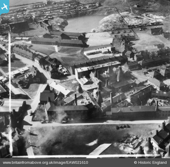
EAW021610 ENGLAND (1949). The Edensor and Cobden China Works and environs, Longton, 1949. This image has been produced from a print marked by Aerofilms Ltd for photo editing.
© Copyright OpenStreetMap contributors and licensed by the OpenStreetMap Foundation. 2026. Cartography is licensed as CC BY-SA.
Nearby Images (31)
EAW021610

EAW021611

EAW021613

EAW021612

EAW021614

EAW021616

EAW021609

EAW030707

EAW030705

EAW030701

EAW030704

EAW030699

EAW030703

EAW030708

EPW020078

EAW030697

EAW030706

EAW030698

EAW030700

EAW018069

EAW030702

EAW018070

EAW018072

EAW018067

EAW013142

EAW013144

EAW018066

EAW018073

EAW018071

EAW018065

EAW018068

Details
| Title | [EAW021610] The Edensor and Cobden China Works and environs, Longton, 1949. This image has been produced from a print marked by Aerofilms Ltd for photo editing. |
| Reference | EAW021610 |
| Date | 25-March-1949 |
| Link | |
| Place name | LONGTON |
| Parish | |
| District | |
| Country | ENGLAND |
| Easting / Northing | 390758, 343188 |
| Longitude / Latitude | -2.1376810623618, 52.985640748949 |
| National Grid Reference | SJ908432 |
Pins
Be the first to add a comment to this image!