
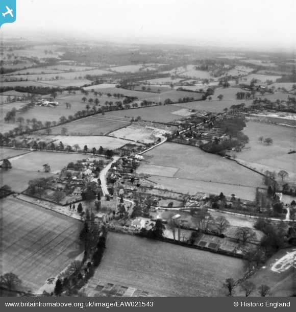
EAW021543 ENGLAND (1949). The village, Slinfold, from the north-west, 1949. This image has been produced from a print.
© Copyright OpenStreetMap contributors and licensed by the OpenStreetMap Foundation. 2024. Cartography is licensed as CC BY-SA.
Nearby Images (3)
EAW021543

EAW021544

EAW021545

Details
| Title | [EAW021543] The village, Slinfold, from the north-west, 1949. This image has been produced from a print. |
| Reference | EAW021543 |
| Date | 21-March-1949 |
| Link | |
| Place name | SLINFOLD |
| Parish | SLINFOLD |
| District | |
| Country | ENGLAND |
| Easting / Northing | 511712, 131558 |
| Longitude / Latitude | -0.4053087557516, 51.071931588767 |
| National Grid Reference | TQ117316 |
Pins
Be the first to add a comment to this image!