
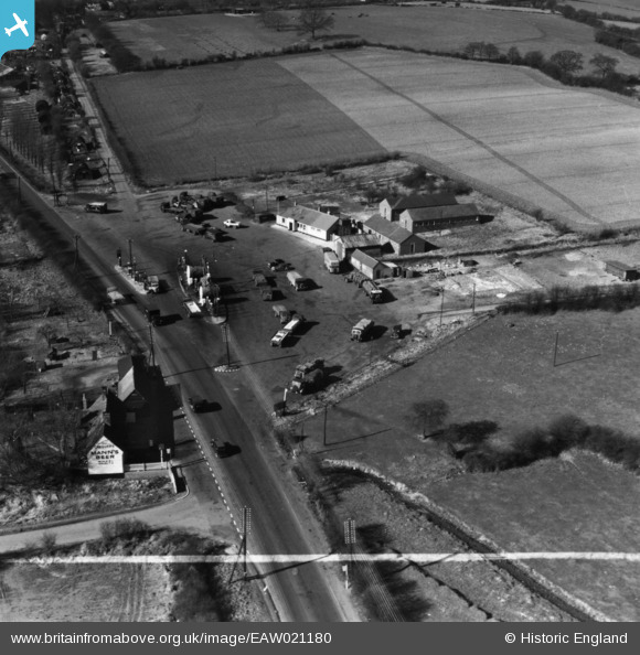
EAW021180 ENGLAND (1949). Watling Street Filling Station, Friar's Wash, 1949. This image has been produced from a print marked by Aerofilms Ltd for photo editing.
© Copyright OpenStreetMap contributors and licensed by the OpenStreetMap Foundation. 2026. Cartography is licensed as CC BY-SA.
Nearby Images (7)
EAW021180

EAW021179

EAW021178

EAW021176

EAW021174

EAW021175

EAW021177

Details
| Title | [EAW021180] Watling Street Filling Station, Friar's Wash, 1949. This image has been produced from a print marked by Aerofilms Ltd for photo editing. |
| Reference | EAW021180 |
| Date | 3-March-1949 |
| Link | |
| Place name | FRIAR'S WASH |
| Parish | FLAMSTEAD |
| District | |
| Country | ENGLAND |
| Easting / Northing | 508571, 215044 |
| Longitude / Latitude | -0.42450457372442, 51.823010233828 |
| National Grid Reference | TL086150 |
Pins
 |

Billy Turner |
Friday 7th of October 2016 08:28:45 PM |