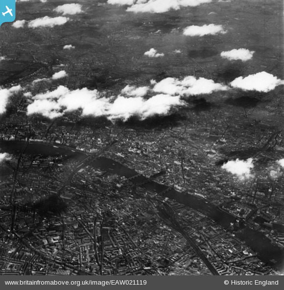
EAW021119 ENGLAND (1949). A cityscape over the River Thames, London, 1949. This image has been produced from a print.
© Copyright OpenStreetMap contributors and licensed by the OpenStreetMap Foundation. 2026. Cartography is licensed as CC BY-SA.
Nearby Images (48)
Details
| Title | [EAW021119] A cityscape over the River Thames, London, 1949. This image has been produced from a print. |
| Reference | EAW021119 |
| Date | 22-March-1949 |
| Link | |
| Place name | LONDON |
| Parish | |
| District | |
| Country | ENGLAND |
| Easting / Northing | 532053, 181304 |
| Longitude / Latitude | -0.096693672589106, 51.514723735309 |
| National Grid Reference | TQ321813 |
Pins
Be the first to add a comment to this image!


![[EAW021119] A cityscape over the River Thames, London, 1949. This image has been produced from a print.](http://britainfromabove.org.uk/sites/all/libraries/aerofilms-images/public/100x100/EAW/021/EAW021119.jpg)
![[EPW011928] St Paul's Cathedral and environs, London, 1924. This image has been produced from a print.](http://britainfromabove.org.uk/sites/all/libraries/aerofilms-images/public/100x100/EPW/011/EPW011928.jpg)
![[EPW056674] St Paul's Cathedral and the City, London, 1938](http://britainfromabove.org.uk/sites/all/libraries/aerofilms-images/public/100x100/EPW/056/EPW056674.jpg)
![[EPW045610] The River Thames and the city from Blackfriars Bridge to London Bridge, London, from the north, 1934](http://britainfromabove.org.uk/sites/all/libraries/aerofilms-images/public/100x100/EPW/045/EPW045610.jpg)
![[EPW039573] A cityscape centred on St Paul's Cathedral, London, 1932. This image has been produced from a copy-negative.](http://britainfromabove.org.uk/sites/all/libraries/aerofilms-images/public/100x100/EPW/039/EPW039573.jpg)
![[EPW011930] St Paul's Cathedral and environs, London, 1924. This image has been produced from a copy-negative affected by flare.](http://britainfromabove.org.uk/sites/all/libraries/aerofilms-images/public/100x100/EPW/011/EPW011930.jpg)
![[EPW009012] St Paul's Cathedral, London, 1923. This image has been produced from a copy-negative.](http://britainfromabove.org.uk/sites/all/libraries/aerofilms-images/public/100x100/EPW/009/EPW009012.jpg)
![[EPW005315] St Paul's Cathedral, London, 1921](http://britainfromabove.org.uk/sites/all/libraries/aerofilms-images/public/100x100/EPW/005/EPW005315.jpg)
![[EAW018352] St Paul's Cathedral and Blackfriars Bridge, London, 1948. This image has been produced from a print.](http://britainfromabove.org.uk/sites/all/libraries/aerofilms-images/public/100x100/EAW/018/EAW018352.jpg)
![[EAW005231] St Paul's Cathedral and surrounding area, London, 1947](http://britainfromabove.org.uk/sites/all/libraries/aerofilms-images/public/100x100/EAW/005/EAW005231.jpg)
![[EAW006470] St Paul's Cathedral and environs, London, 1947](http://britainfromabove.org.uk/sites/all/libraries/aerofilms-images/public/100x100/EAW/006/EAW006470.jpg)
![[EPW030088] St Paul's Cathedral, London, 1929](http://britainfromabove.org.uk/sites/all/libraries/aerofilms-images/public/100x100/EPW/030/EPW030088.jpg)
![[EPW005922] St Paul's Cathedral, London, 1921](http://britainfromabove.org.uk/sites/all/libraries/aerofilms-images/public/100x100/EPW/005/EPW005922.jpg)
![[EPW009351] St Pauls Cathedral and environs, London, 1923](http://britainfromabove.org.uk/sites/all/libraries/aerofilms-images/public/100x100/EPW/009/EPW009351.jpg)
![[EPW062040] St Paul's Cathedral and the city, London, from the west, 1939](http://britainfromabove.org.uk/sites/all/libraries/aerofilms-images/public/100x100/EPW/062/EPW062040.jpg)
![[EAW006469] St Paul's Cathedral and environs, London, 1947](http://britainfromabove.org.uk/sites/all/libraries/aerofilms-images/public/100x100/EAW/006/EAW006469.jpg)
![[EPW005583] St Paul's Cathedral, London, 1921](http://britainfromabove.org.uk/sites/all/libraries/aerofilms-images/public/100x100/EPW/005/EPW005583.jpg)
![[EPW006782] St Paul's Cathedral, London, 1921](http://britainfromabove.org.uk/sites/all/libraries/aerofilms-images/public/100x100/EPW/006/EPW006782.jpg)
![[EAW041961] St Paul's Cathedral, London, 1952](http://britainfromabove.org.uk/sites/all/libraries/aerofilms-images/public/100x100/EAW/041/EAW041961.jpg)
![[EPW005903] St Paul's Cathedral, London, 1921](http://britainfromabove.org.uk/sites/all/libraries/aerofilms-images/public/100x100/EPW/005/EPW005903.jpg)
![[EPW001613] St Paul's Cathedral, London, 1920](http://britainfromabove.org.uk/sites/all/libraries/aerofilms-images/public/100x100/EPW/001/EPW001613.jpg)
![[EPW021775] St Paul's Cathedral and surroundings, London, 1928](http://britainfromabove.org.uk/sites/all/libraries/aerofilms-images/public/100x100/EPW/021/EPW021775.jpg)
![[EAW033179] A cityscape over St Paul's Cathedral, London, 1950](http://britainfromabove.org.uk/sites/all/libraries/aerofilms-images/public/100x100/EAW/033/EAW033179.jpg)
![[EAW046477] St Paul's Cathedral and surrounding cleared areas, London, 1952](http://britainfromabove.org.uk/sites/all/libraries/aerofilms-images/public/100x100/EAW/046/EAW046477.jpg)
![[EPW030089] St Paul's Cathedral and environs, London, 1929](http://britainfromabove.org.uk/sites/all/libraries/aerofilms-images/public/100x100/EPW/030/EPW030089.jpg)
![[EPW024273] St Paul's Cathedral and environs, London, 1928. This image has been produced from a copy-negative.](http://britainfromabove.org.uk/sites/all/libraries/aerofilms-images/public/100x100/EPW/024/EPW024273.jpg)
![[EPW021772] St Paul's Cathedral and surroundings, London, 1928](http://britainfromabove.org.uk/sites/all/libraries/aerofilms-images/public/100x100/EPW/021/EPW021772.jpg)
![[EPW021773] St Paul's Cathedral and surroundings, London, 1928](http://britainfromabove.org.uk/sites/all/libraries/aerofilms-images/public/100x100/EPW/021/EPW021773.jpg)
![[EAW021092] St Paul's Cathedral, London, 1949. This image has been produced from a print.](http://britainfromabove.org.uk/sites/all/libraries/aerofilms-images/public/100x100/EAW/021/EAW021092.jpg)
![[EAW000659] St Paul's Cathedral and the surrounding area, London, 1946](http://britainfromabove.org.uk/sites/all/libraries/aerofilms-images/public/100x100/EAW/000/EAW000659.jpg)
![[EPW011931] St Paul's Cathedral and environs, London, 1924. This image has been produced from a print.](http://britainfromabove.org.uk/sites/all/libraries/aerofilms-images/public/100x100/EPW/011/EPW011931.jpg)
![[EAW020404] St Paul's Cathedral and environs, London, 1948](http://britainfromabove.org.uk/sites/all/libraries/aerofilms-images/public/100x100/EAW/020/EAW020404.jpg)
![[EPW055304] St Paul's Cathedral and the city, London, from the south, 1937](http://britainfromabove.org.uk/sites/all/libraries/aerofilms-images/public/100x100/EPW/055/EPW055304.jpg)
![[EPW020963] St Paul's Cathedral, London, 1928](http://britainfromabove.org.uk/sites/all/libraries/aerofilms-images/public/100x100/EPW/020/EPW020963.jpg)
![[EAW021093] St Paul's Cathedral, London, 1949. This image has been produced from a print.](http://britainfromabove.org.uk/sites/all/libraries/aerofilms-images/public/100x100/EAW/021/EAW021093.jpg)
![[EPW021774] St Paul's Cathedral and surroundings, London, 1928](http://britainfromabove.org.uk/sites/all/libraries/aerofilms-images/public/100x100/EPW/021/EPW021774.jpg)
![[EAW000507] St Paul's Cathedral and environs, London, 1946](http://britainfromabove.org.uk/sites/all/libraries/aerofilms-images/public/100x100/EAW/000/EAW000507.jpg)
![[EAW011179] St Paul's Cathedral and surrounding cleared areas following bomb damage, London, 1947](http://britainfromabove.org.uk/sites/all/libraries/aerofilms-images/public/100x100/EAW/011/EAW011179.jpg)
![[EAW018350] St Paul's Cathedral and the city, London, from the south, 1948. This image has been produced from a print.](http://britainfromabove.org.uk/sites/all/libraries/aerofilms-images/public/100x100/EAW/018/EAW018350.jpg)
![[EAW011190] King Edward Street, St Bartholomew's Hospital and environs, London, 1947](http://britainfromabove.org.uk/sites/all/libraries/aerofilms-images/public/100x100/EAW/011/EAW011190.jpg)
![[EAW011098] Newgate Street and environs, London, 1947](http://britainfromabove.org.uk/sites/all/libraries/aerofilms-images/public/100x100/EAW/011/EAW011098.jpg)
![[EAW028759] Ludgate Hill, St Paul's Cathedral and surrounding streets, London, 1950. This image was marked by Aerofilms Ltd for photo editing.](http://britainfromabove.org.uk/sites/all/libraries/aerofilms-images/public/100x100/EAW/028/EAW028759.jpg)
![[EAW018343] St Bathlomew's Hospital and the Old Bailey, London, 1948. This image has been produced from a print.](http://britainfromabove.org.uk/sites/all/libraries/aerofilms-images/public/100x100/EAW/018/EAW018343.jpg)
![[EPW015771] St Paul's Cathedral, Blackfriars Bridge and environs, City of London, 1926](http://britainfromabove.org.uk/sites/all/libraries/aerofilms-images/public/100x100/EPW/015/EPW015771.jpg)
![[EPR000687] St Paul's Cathedral and environs, London, 1935. This image has been produced from a damaged negative.](http://britainfromabove.org.uk/sites/all/libraries/aerofilms-images/public/100x100/EPR/000/EPR000687.jpg)
![[EAW049465] Smithfield Market (London Central Markets) looking towards St Paul's Cathedral and the River Thames, London, 1953](http://britainfromabove.org.uk/sites/all/libraries/aerofilms-images/public/100x100/EAW/049/EAW049465.jpg)
![[EAW011107] Holborn Viaduct, Newgate Street and environs, Holborn, 1947](http://britainfromabove.org.uk/sites/all/libraries/aerofilms-images/public/100x100/EAW/011/EAW011107.jpg)
![[EAW011180] St Andrew's Hill, Ludgate Hill and environs, London, 1947](http://britainfromabove.org.uk/sites/all/libraries/aerofilms-images/public/100x100/EAW/011/EAW011180.jpg)