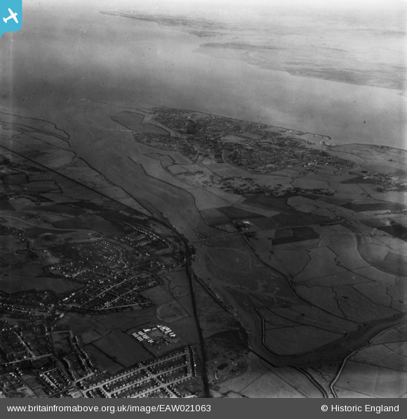
EAW021063 ENGLAND (1949). Hadleigh Ray and the River Thames, Canvey Island, 1949. This image has been produced from a print.
© Copyright OpenStreetMap contributors and licensed by the OpenStreetMap Foundation. 2026. Cartography is licensed as CC BY-SA.
Nearby Images (6)
Details
| Title | [EAW021063] Hadleigh Ray and the River Thames, Canvey Island, 1949. This image has been produced from a print. |
| Reference | EAW021063 |
| Date | 16-February-1949 |
| Link | |
| Place name | CANVEY ISLAND |
| Parish | CANVEY ISLAND |
| District | |
| Country | ENGLAND |
| Easting / Northing | 577567, 185894 |
| Longitude / Latitude | 0.56100867148914, 51.543487170728 |
| National Grid Reference | TQ776859 |
Pins

tiv |
Saturday 4th of November 2017 08:19:04 AM |


![[EAW021063] Hadleigh Ray and the River Thames, Canvey Island, 1949. This image has been produced from a print.](http://britainfromabove.org.uk/sites/all/libraries/aerofilms-images/public/100x100/EAW/021/EAW021063.jpg)
![[EAW026793] Benfleet Railway Station and environs, South Benfleet, 1949. This image has been produced from a print.](http://britainfromabove.org.uk/sites/all/libraries/aerofilms-images/public/100x100/EAW/026/EAW026793.jpg)
![[EAW026792] Benfleet Railway Station and environs, South Benfleet, 1949. This image has been produced from a print.](http://britainfromabove.org.uk/sites/all/libraries/aerofilms-images/public/100x100/EAW/026/EAW026792.jpg)
![[EAW026791] Benfleet Creek, Benfleet Railway Station and the town, South Benfleet, 1949. This image has been produced from a print.](http://britainfromabove.org.uk/sites/all/libraries/aerofilms-images/public/100x100/EAW/026/EAW026791.jpg)
![[EAW026789] Benfleet Creek and the town, South Benfleet, 1949](http://britainfromabove.org.uk/sites/all/libraries/aerofilms-images/public/100x100/EAW/026/EAW026789.jpg)
![[EAW026788] Benfleet Creek and the town, South Benfleet, 1949](http://britainfromabove.org.uk/sites/all/libraries/aerofilms-images/public/100x100/EAW/026/EAW026788.jpg)