
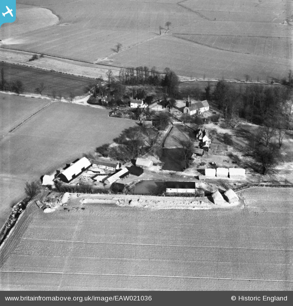
EAW021036 ENGLAND (1949). St Mary's Church and the village, Great Canfield, 1949
© Copyright OpenStreetMap contributors and licensed by the OpenStreetMap Foundation. 2026. Cartography is licensed as CC BY-SA.
Nearby Images (3)
EAW021036

EAW021035
, St Mary's Church and the village, Great Canfield, 1949")
EAW021037
 and the village, Great Canfield, 1949")
Details
| Title | [EAW021036] St Mary's Church and the village, Great Canfield, 1949 |
| Reference | EAW021036 |
| Date | 16-February-1949 |
| Link | |
| Place name | GREAT CANFIELD |
| Parish | GREAT CANFIELD |
| District | |
| Country | ENGLAND |
| Easting / Northing | 559290, 217954 |
| Longitude / Latitude | 0.31228461499981, 51.8369995329 |
| National Grid Reference | TL593180 |
Pins
Be the first to add a comment to this image!