
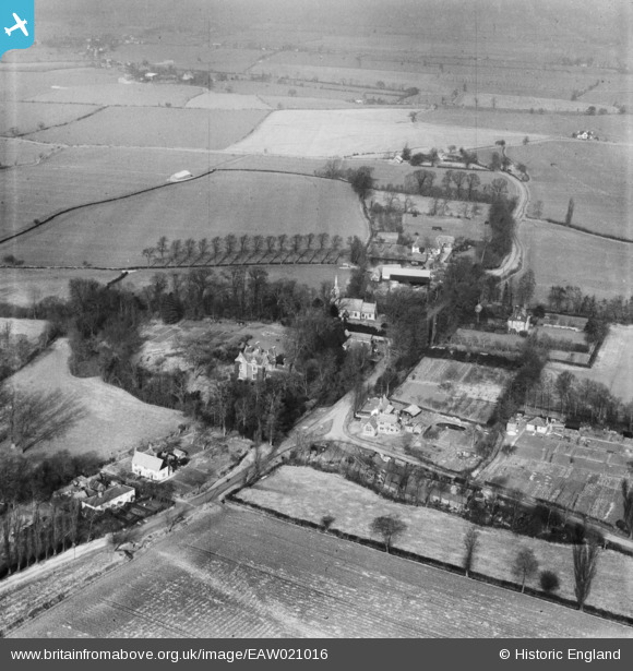
EAW021016 ENGLAND (1949). St Edmund's Church and the village, Abbess Roding, 1949
© Copyright OpenStreetMap contributors and licensed by the OpenStreetMap Foundation. 2025. Cartography is licensed as CC BY-SA.
Nearby Images (3)
EAW021016

EAW021014

EAW021015

Details
| Title | [EAW021016] St Edmund's Church and the village, Abbess Roding, 1949 |
| Reference | EAW021016 |
| Date | 16-March-1949 |
| Link | |
| Place name | ABBESS RODING |
| Parish | ABBESS BEAUCHAMP AND BERNERS RODING |
| District | |
| Country | ENGLAND |
| Easting / Northing | 557154, 211423 |
| Longitude / Latitude | 0.27834272847421, 51.778924299059 |
| National Grid Reference | TL572114 |
Pins
Be the first to add a comment to this image!