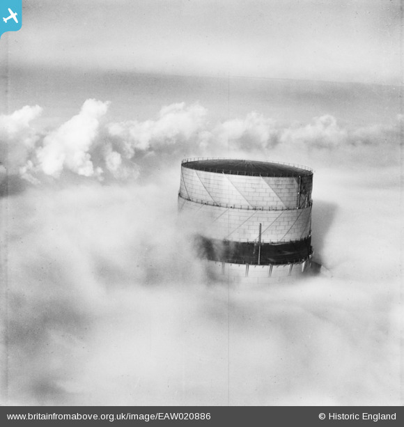
EAW020886 ENGLAND (1949). The gasometer under fog, Hitchin, 1949
© Copyright OpenStreetMap contributors and licensed by the OpenStreetMap Foundation. 2026. Cartography is licensed as CC BY-SA.
Details
| Title | [EAW020886] The gasometer under fog, Hitchin, 1949 |
| Reference | EAW020886 |
| Date | 2-February-1949 |
| Link | |
| Place name | HITCHIN |
| Parish | |
| District | |
| Country | ENGLAND |
| Easting / Northing | 518929, 231000 |
| Longitude / Latitude | -0.26876422375074, 51.964310751385 |
| National Grid Reference | TL189310 |
Pins
Be the first to add a comment to this image!


![[EAW020886] The gasometer under fog, Hitchin, 1949](http://britainfromabove.org.uk/sites/all/libraries/aerofilms-images/public/100x100/EAW/020/EAW020886.jpg)
![[EAW020884] The gasometer under fog, Hitchin, 1949](http://britainfromabove.org.uk/sites/all/libraries/aerofilms-images/public/100x100/EAW/020/EAW020884.jpg)
![[EAW020887] The gasometer under fog, Hitchin, 1949](http://britainfromabove.org.uk/sites/all/libraries/aerofilms-images/public/100x100/EAW/020/EAW020887.jpg)
![[EAW020885] The gasometer and the plume from a passing steam locomotive under fog, Hitchin, 1949](http://britainfromabove.org.uk/sites/all/libraries/aerofilms-images/public/100x100/EAW/020/EAW020885.jpg)