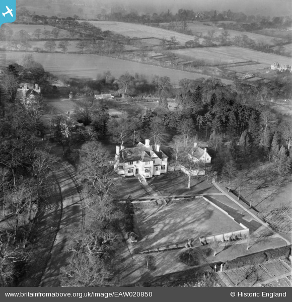
EAW020850 ENGLAND (1949). Hilltop on Deacon's Hill Lane, Elstree, 1949
© Copyright OpenStreetMap contributors and licensed by the OpenStreetMap Foundation. 2026. Cartography is licensed as CC BY-SA.
Details
| Title | [EAW020850] Hilltop on Deacon's Hill Lane, Elstree, 1949 |
| Reference | EAW020850 |
| Date | 2-February-1949 |
| Link | |
| Place name | ELSTREE |
| Parish | ELSTREE AND BOREHAMWOOD |
| District | |
| Country | ENGLAND |
| Easting / Northing | 519131, 195443 |
| Longitude / Latitude | -0.27804825081936, 51.64468308208 |
| National Grid Reference | TQ191954 |
Pins
Be the first to add a comment to this image!
User Comment Contributions
Recorded in the original Aerofilms Ltd Register as "Anna Neagle's house". See also EAW023663. |
Katy Whitaker |
Wednesday 27th of August 2014 12:02:17 PM |


![[EAW020850] Hilltop on Deacon's Hill Lane, Elstree, 1949](http://britainfromabove.org.uk/sites/all/libraries/aerofilms-images/public/100x100/EAW/020/EAW020850.jpg)
![[EAW023663] Hartfield House (the home of Anna Neagle), Elstree, 1949](http://britainfromabove.org.uk/sites/all/libraries/aerofilms-images/public/100x100/EAW/023/EAW023663.jpg)
![[EAW021434] Hartfield House (the home of Anna Neagle), Elstree, 1949. This image has been produced from a print.](http://britainfromabove.org.uk/sites/all/libraries/aerofilms-images/public/100x100/EAW/021/EAW021434.jpg)
![[EAW023707] High Carrs and Red Roof Cottage, Elstree, 1949](http://britainfromabove.org.uk/sites/all/libraries/aerofilms-images/public/100x100/EAW/023/EAW023707.jpg)