
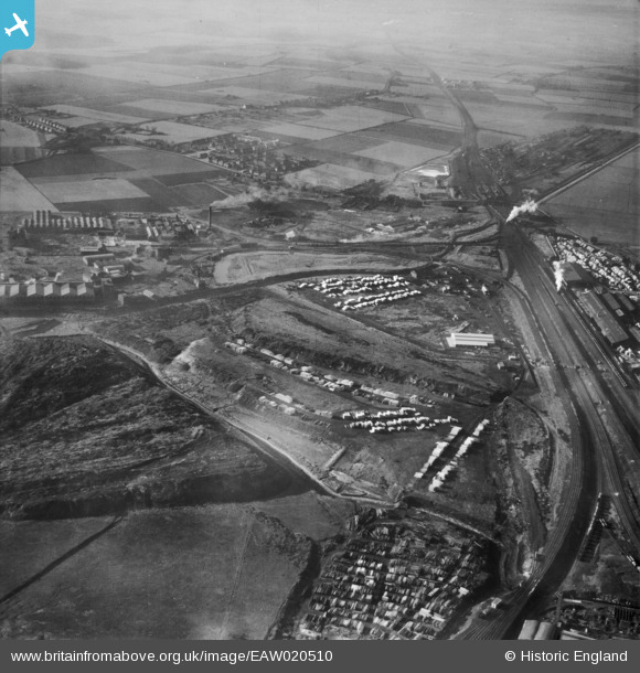
EAW020510 ENGLAND (1948). Ditton Marsh and the surrounding industrial area, Widnes, from the east, 1948
© Copyright OpenStreetMap contributors and licensed by the OpenStreetMap Foundation. 2026. Cartography is licensed as CC BY-SA.
Nearby Images (3)
EAW020510

EAW020502

EAW020503

Details
| Title | [EAW020510] Ditton Marsh and the surrounding industrial area, Widnes, from the east, 1948 |
| Reference | EAW020510 |
| Date | 10-November-1948 |
| Link | |
| Place name | WIDNES |
| Parish | |
| District | |
| Country | ENGLAND |
| Easting / Northing | 349886, 384399 |
| Longitude / Latitude | -2.7529884598615, 53.353830414681 |
| National Grid Reference | SJ499844 |
Pins

Ginger79 |
Saturday 12th of April 2025 12:46:07 AM | |
|
Ginger79 |
Saturday 12th of April 2025 12:44:15 AM | |
|
Ginger79 |
Thursday 8th of July 2021 09:54:40 PM | |
|
Ginger79 |
Saturday 26th of June 2021 06:46:53 PM | |
|
Ginger79 |
Saturday 26th of June 2021 06:46:19 PM | |
|
Ginger79 |
Saturday 26th of June 2021 06:45:29 PM | |
|
Ginger79 |
Tuesday 15th of June 2021 09:39:39 PM | |
|
Ginger79 |
Tuesday 15th of June 2021 09:36:06 PM | |
|
Ginger79 |
Wednesday 15th of January 2020 05:03:11 AM | |
|
Ginger79 |
Tuesday 30th of April 2019 05:23:59 PM | |

Bottom Yard |
Tuesday 26th of March 2019 01:57:58 PM | |
|
Bottom Yard |
Saturday 9th of March 2019 05:21:51 PM | |
|
Bottom Yard |
Sunday 20th of January 2019 07:50:26 PM | |
|
Bottom Yard |
Sunday 20th of January 2019 07:42:28 PM | |
|
Bottom Yard |
Sunday 20th of January 2019 07:33:20 PM | |
|
Bottom Yard |
Sunday 20th of January 2019 07:30:28 PM | |
|
Bottom Yard |
Sunday 20th of January 2019 07:00:52 PM | |
|
Ginger79 |
Tuesday 17th of May 2016 05:45:11 PM | |
|
Ginger79 |
Friday 5th of December 2014 02:40:21 AM | |
|
Ginger79 |
Friday 5th of December 2014 02:39:32 AM | |
|
Barney Rubble |
Thursday 4th of December 2014 10:03:05 PM |


