
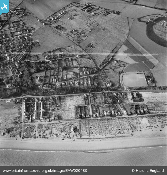
EAW020480 ENGLAND (1948). Wellington Parade and environs, Kingsdown, 1948. This image was marked by Aerofilms Ltd for photo editing.
© Copyright OpenStreetMap contributors and licensed by the OpenStreetMap Foundation. 2026. Cartography is licensed as CC BY-SA.
Details
| Title | [EAW020480] Wellington Parade and environs, Kingsdown, 1948. This image was marked by Aerofilms Ltd for photo editing. |
| Reference | EAW020480 |
| Date | 9-November-1948 |
| Link | |
| Place name | KINGSDOWN |
| Parish | RINGWOULD WITH KINGSDOWN |
| District | |
| Country | ENGLAND |
| Easting / Northing | 637837, 148692 |
| Longitude / Latitude | 1.4039386354722, 51.187363384028 |
| National Grid Reference | TR378487 |
Pins

Jez H |
Monday 20th of June 2022 10:43:57 PM | |

Matt Aldred edob.mattaldred.com |
Tuesday 9th of March 2021 05:06:55 PM | |
|
Matt Aldred edob.mattaldred.com |
Tuesday 9th of March 2021 05:06:40 PM | |
|
cptpies |
Thursday 9th of January 2014 10:47:10 AM | |
|
cptpies |
Thursday 9th of January 2014 10:45:31 AM |
User Comment Contributions

WWII Beach Scaffolding and possible pillbox (e26221) |
cptpies |
Thursday 9th of January 2014 10:48:21 AM |