
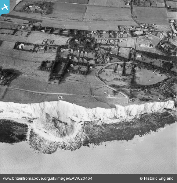
EAW020464 ENGLAND (1948). Foreland Road and environs, St Margaret's at Cliffe, 1948
© Copyright OpenStreetMap contributors and licensed by the OpenStreetMap Foundation. 2026. Cartography is licensed as CC BY-SA.
Nearby Images (2)
EAW020464

EAW020463

Details
| Title | [EAW020464] Foreland Road and environs, St Margaret's at Cliffe, 1948 |
| Reference | EAW020464 |
| Date | 9-November-1948 |
| Link | |
| Place name | ST MARGARET'S AT CLIFFE |
| Parish | ST. MARGARET'S AT CLIFFE |
| District | |
| Country | ENGLAND |
| Easting / Northing | 636576, 143977 |
| Longitude / Latitude | 1.3828235578762, 51.145558591514 |
| National Grid Reference | TR366440 |
Pins

Matt Aldred edob.mattaldred.com |
Monday 30th of November 2020 08:44:07 PM | |

Chris Kolonko |
Saturday 16th of September 2017 08:28:35 PM | |
|
Chris Kolonko |
Saturday 16th of September 2017 08:28:19 PM | |
|
Chris Kolonko |
Saturday 16th of September 2017 08:26:36 PM | |
|
Chris Kolonko |
Saturday 16th of September 2017 08:25:57 PM |