
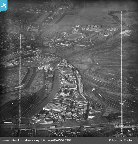
EAW020392 ENGLAND (1948). Industrial premises between Carpenter's Road and Waterworks River and environs, Stratford Marsh, 1948. This image was marked by Aerofilms Ltd for photo editing.
© Copyright OpenStreetMap contributors and licensed by the OpenStreetMap Foundation. 2026. Cartography is licensed as CC BY-SA.
Nearby Images (3)
EAW020392

EPW006767

EPW006763

Details
| Title | [EAW020392] Industrial premises between Carpenter's Road and Waterworks River and environs, Stratford Marsh, 1948. This image was marked by Aerofilms Ltd for photo editing. |
| Reference | EAW020392 |
| Date | 4-November-1948 |
| Link | |
| Place name | STRATFORD MARSH |
| Parish | |
| District | |
| Country | ENGLAND |
| Easting / Northing | 537795, 184452 |
| Longitude / Latitude | -0.012753713990043, 51.541643437704 |
| National Grid Reference | TQ378845 |
Pins

jonnywg |
Thursday 17th of March 2016 12:48:05 PM | |
|
JOHN |
Monday 23rd of March 2015 07:50:21 PM | |
|
JOHN |
Monday 23rd of March 2015 07:47:56 PM | |
|
JOHN |
Monday 23rd of March 2015 07:43:44 PM | |
Opened for greyhound racing April 1932 and Speedway three years later. |
gBr |
Monday 6th of March 2017 09:55:34 PM |