
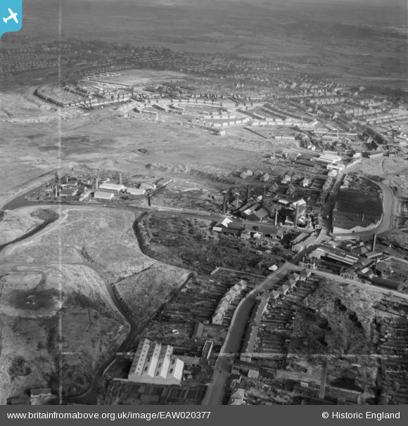
EAW020377 ENGLAND (1948). The Johnson's Iron & Steel Co Ltd Hall End Iron Works looking towards Hall End, West Bromwich, from the south-west, 1948. This image was marked by Aerofilms Ltd for photo editing.
© Copyright OpenStreetMap contributors and licensed by the OpenStreetMap Foundation. 2026. Cartography is licensed as CC BY-SA.
Nearby Images (20)
EAW020377

EAW020378

EAW020372

EAW048803

EAW020373

EAW048807

EAW048806

EAW020370
 and environs, West Bromwich, 1948")
EAW048802

EAW020369

EAW020376
 looking towards Black Lake, West Bromwich, from the south-east, 1948")
EAW020371
 and environs, West Bromwich, 1948")
EAW048808

EAW020381
, the Johnson's Iron & Steel Co Ltd Hall End Iron Works and environs, West Bromwich, 1948. This image was marked by Aerofilms Ltd for photo editing.")
EAW048805

EAW020380

EAW020379

EAW048801

EAW042874

EAW042880

Details
| Title | [EAW020377] The Johnson's Iron & Steel Co Ltd Hall End Iron Works looking towards Hall End, West Bromwich, from the south-west, 1948. This image was marked by Aerofilms Ltd for photo editing. |
| Reference | EAW020377 |
| Date | 4-November-1948 |
| Link | |
| Place name | WEST BROMWICH |
| Parish | |
| District | |
| Country | ENGLAND |
| Easting / Northing | 399895, 292621 |
| Longitude / Latitude | -2.0015480185776, 52.531093578593 |
| National Grid Reference | SO999926 |
