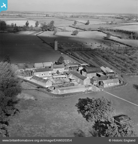
EAW020354 ENGLAND (1948). Moulton Grounds Farm, Moulton, 1948
© Copyright OpenStreetMap contributors and licensed by the OpenStreetMap Foundation. 2024. Cartography is licensed as CC BY-SA.
Nearby Images (7)
Details
| Title | [EAW020354] Moulton Grounds Farm, Moulton, 1948 |
| Reference | EAW020354 |
| Date | 4-November-1948 |
| Link | |
| Place name | MOULTON |
| Parish | MOULTON |
| District | |
| Country | ENGLAND |
| Easting / Northing | 477789, 266794 |
| Longitude / Latitude | -0.85928478882041, 52.293371560832 |
| National Grid Reference | SP778668 |
Pins
Be the first to add a comment to this image!


![[EAW020354] Moulton Grounds Farm, Moulton, 1948](http://britainfromabove.org.uk/sites/all/libraries/aerofilms-images/public/100x100/EAW/020/EAW020354.jpg)
![[EAW020350] Moulton Grounds Farm, Moulton, from the south-west, 1948](http://britainfromabove.org.uk/sites/all/libraries/aerofilms-images/public/100x100/EAW/020/EAW020350.jpg)
![[EAW020353] Moulton Grounds Farm, Moulton, from the south-east, 1948](http://britainfromabove.org.uk/sites/all/libraries/aerofilms-images/public/100x100/EAW/020/EAW020353.jpg)
![[EAW020351] Moulton Grounds Farm, Moulton, from the south, 1948](http://britainfromabove.org.uk/sites/all/libraries/aerofilms-images/public/100x100/EAW/020/EAW020351.jpg)
![[EAW020352] Moulton Grounds Farm, Moulton, from the south-east, 1948](http://britainfromabove.org.uk/sites/all/libraries/aerofilms-images/public/100x100/EAW/020/EAW020352.jpg)
![[EAW020358] Northamptonshire Institute of Agriculture and Moulton Grounds Farm, Moulton, 1948](http://britainfromabove.org.uk/sites/all/libraries/aerofilms-images/public/100x100/EAW/020/EAW020358.jpg)
![[EAW020357] Northamptonshire Institute of Agriculture and Moulton Grounds Farm, Moulton, 1948](http://britainfromabove.org.uk/sites/all/libraries/aerofilms-images/public/100x100/EAW/020/EAW020357.jpg)