
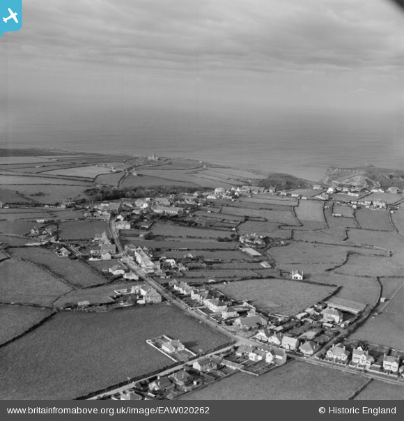
EAW020262 ENGLAND (1948). Bossiney Road looking towards St Materiana's Church and the sea, Tintagel, from the east, 1948
© Copyright OpenStreetMap contributors and licensed by the OpenStreetMap Foundation. 2026. Cartography is licensed as CC BY-SA.
Details
| Title | [EAW020262] Bossiney Road looking towards St Materiana's Church and the sea, Tintagel, from the east, 1948 |
| Reference | EAW020262 |
| Date | 27-October-1948 |
| Link | |
| Place name | TINTAGEL |
| Parish | TINTAGEL |
| District | |
| Country | ENGLAND |
| Easting / Northing | 206132, 88447 |
| Longitude / Latitude | -4.7434824116877, 50.662795115045 |
| National Grid Reference | SX061884 |
Pins

buryblackpud |
Friday 19th of May 2023 01:59:48 PM | |
|
Andy Burton |
Thursday 23rd of July 2015 02:58:59 PM | |
|
CornwallPhil |
Tuesday 15th of July 2014 09:17:24 PM |
User Comment Contributions

RAF Dunderhole |
CornwallPhil |
Tuesday 15th of July 2014 09:20:25 PM |