
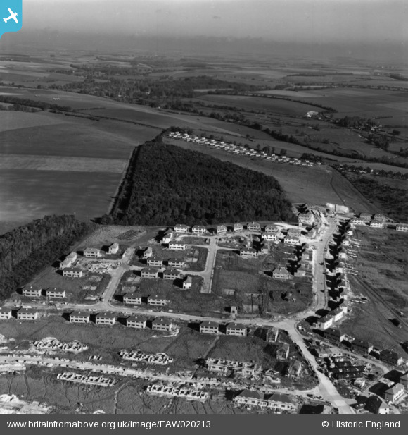
EAW020213 ENGLAND (1948). Housing development surrounding Winding Way and Bemerton Heath, Salisbury, from the south, 1948. This image has been produced from a print.
© Copyright OpenStreetMap contributors and licensed by the OpenStreetMap Foundation. 2026. Cartography is licensed as CC BY-SA.
Nearby Images (9)
EAW020213

EAW020209

EAW020211

EAW020210

EAW020212

EAW020215

EAW020216

EAW020214

EAW020217

Details
| Title | [EAW020213] Housing development surrounding Winding Way and Bemerton Heath, Salisbury, from the south, 1948. This image has been produced from a print. |
| Reference | EAW020213 |
| Date | 26-October-1948 |
| Link | |
| Place name | SALISBURY |
| Parish | SALISBURY |
| District | |
| Country | ENGLAND |
| Easting / Northing | 411983, 131378 |
| Longitude / Latitude | -1.8289133061491, 51.081065161109 |
| National Grid Reference | SU120314 |
Pins

Western Way |
Friday 25th of September 2020 04:10:10 PM | |
|
helburt |
Monday 15th of February 2016 07:28:09 PM | |
|
helburt |
Monday 15th of February 2016 07:27:13 PM | |
|
helburt |
Monday 15th of February 2016 07:27:11 PM | |
|
helburt |
Monday 15th of February 2016 07:27:08 PM |