
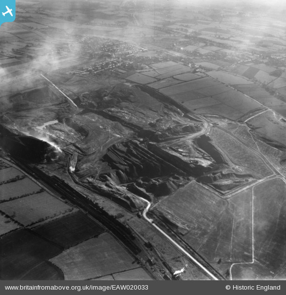
EAW020033 ENGLAND (1948). Fordbridge Meadow Opencast Coal Site, South Normanton, 1948. This image has been produced from a print marked by Aerofilms Ltd for photo editing.
© Copyright OpenStreetMap contributors and licensed by the OpenStreetMap Foundation. 2026. Cartography is licensed as CC BY-SA.
Nearby Images (5)
EAW020033

EAW020032

EAW020034

EAW020029

EAW020027

Details
| Title | [EAW020033] Fordbridge Meadow Opencast Coal Site, South Normanton, 1948. This image has been produced from a print marked by Aerofilms Ltd for photo editing. |
| Reference | EAW020033 |
| Date | 19-October-1948 |
| Link | |
| Place name | SOUTH NORMANTON |
| Parish | SOUTH NORMANTON |
| District | |
| Country | ENGLAND |
| Easting / Northing | 443307, 357327 |
| Longitude / Latitude | -1.3529621753755, 53.111073815589 |
| National Grid Reference | SK433573 |
Pins
Be the first to add a comment to this image!