
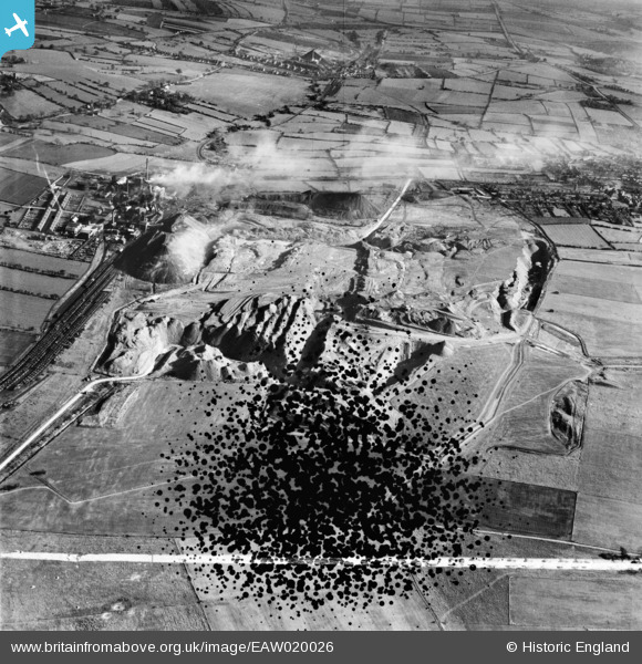
EAW020026 ENGLAND (1948). Fordbridge Meadow Opencast Coal Site, South Normanton, 1948. This image has been produced from a damaged negative.
© Copyright OpenStreetMap contributors and licensed by the OpenStreetMap Foundation. 2026. Cartography is licensed as CC BY-SA.
Nearby Images (8)
EAW020026

EAW020025
, South Normanton, 1948. This image has been produced from a damaged negative.")
EAW020027

EAW020028

EAW020029

EAW020031

EAW020030

EAW020032

Details
| Title | [EAW020026] Fordbridge Meadow Opencast Coal Site, South Normanton, 1948. This image has been produced from a damaged negative. |
| Reference | EAW020026 |
| Date | 19-October-1948 |
| Link | |
| Place name | SOUTH NORMANTON |
| Parish | SOUTH NORMANTON |
| District | |
| Country | ENGLAND |
| Easting / Northing | 443558, 357344 |
| Longitude / Latitude | -1.3492100107719, 53.111206196979 |
| National Grid Reference | SK436573 |
Pins

Spartanhouse |
Friday 18th of February 2022 12:22:18 AM | |
|
Spartanhouse |
Friday 18th of February 2022 12:20:55 AM | |

dd1000 |
Thursday 18th of July 2019 02:18:20 PM | |
|
dd1000 |
Thursday 18th of July 2019 02:16:34 PM | |
|
dd1000 |
Thursday 18th of July 2019 02:04:04 PM | |
|
dd1000 |
Thursday 18th of July 2019 01:48:53 PM | |
 |
dd1000 |
Thursday 18th of July 2019 01:45:00 PM |
