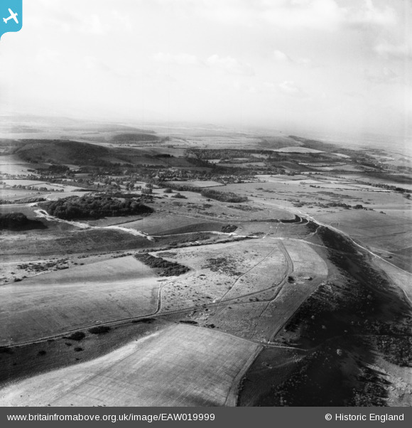
EAW019999 ENGLAND (1948). Cissbury Ring and Vineyard Hill, Cissbury Ring, from the east, 1948
© Copyright OpenStreetMap contributors and licensed by the OpenStreetMap Foundation. 2025. Cartography is licensed as CC BY-SA.
Details
| Title | [EAW019999] Cissbury Ring and Vineyard Hill, Cissbury Ring, from the east, 1948 |
| Reference | EAW019999 |
| Date | 19-October-1948 |
| Link | |
| Place name | CISSBURY RING |
| Parish | |
| District | |
| Country | ENGLAND |
| Easting / Northing | 514337, 108001 |
| Longitude / Latitude | -0.37525875696627, 50.859644293706 |
| National Grid Reference | TQ143080 |
Pins
Be the first to add a comment to this image!
User Comment Contributions
The largest hillfort in Sussex, said to date back 5,000 years |
 MB |
Monday 13th of January 2014 02:20:48 PM |


![[EAW019999] Cissbury Ring and Vineyard Hill, Cissbury Ring, from the east, 1948](http://britainfromabove.org.uk/sites/all/libraries/aerofilms-images/public/100x100/EAW/019/EAW019999.jpg)
![[EAW019998] Cissbury Ring and Vineyard Hill, Cissbury Ring, from the east, 1948](http://britainfromabove.org.uk/sites/all/libraries/aerofilms-images/public/100x100/EAW/019/EAW019998.jpg)