
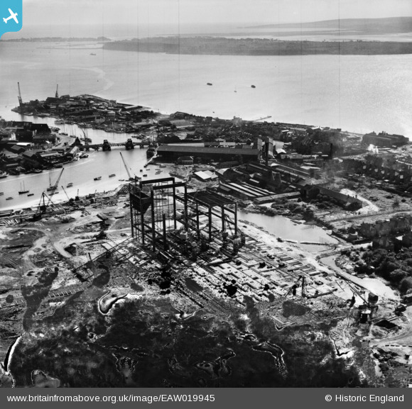
EAW019945 ENGLAND (1948). Construction of the Hamworthy Power Station, Lower Hamworthy, from the north-west, 1948. This image has been produced from a damaged negative.
© Copyright OpenStreetMap contributors and licensed by the OpenStreetMap Foundation. 2026. Cartography is licensed as CC BY-SA.
Nearby Images (24)
EAW019945

EAW004209

EAW004198

EAW004203

EAW004206

EAW004201

EAW019950

EAW019948

EAW019953

EAW019947

EAW004202

EAW004208

EAW004204

EAW019955

EAW004207

EAW004196

EAW004197

EAW004195

EAW019952

EAW004205

EAW004199

EAW019944

EAW004200

EAW019946

Details
| Title | [EAW019945] Construction of the Hamworthy Power Station, Lower Hamworthy, from the north-west, 1948. This image has been produced from a damaged negative. |
| Reference | EAW019945 |
| Date | 19-October-1948 |
| Link | |
| Place name | LOWER HAMWORTHY |
| Parish | |
| District | |
| Country | ENGLAND |
| Easting / Northing | 400294, 90759 |
| Longitude / Latitude | -1.9958351337054, 50.715885996651 |
| National Grid Reference | SZ003908 |
Pins
Be the first to add a comment to this image!