
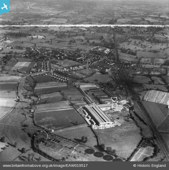
EAW019517 ENGLAND (1948). The John Garrington and Sons Ltd Newton Engineering Works and the village, Aston Fields, from the south-west, 1948. This image has been produced from a print marked by Aerofilms Ltd for photo editing.
© Copyright OpenStreetMap contributors and licensed by the OpenStreetMap Foundation. 2026. Cartography is licensed as CC BY-SA.
Nearby Images (5)
EAW019517

EAW019514

EAW019518

EAW019516

EAW019519

Details
| Title | [EAW019517] The John Garrington and Sons Ltd Newton Engineering Works and the village, Aston Fields, from the south-west, 1948. This image has been produced from a print marked by Aerofilms Ltd for photo editing. |
| Reference | EAW019517 |
| Date | 5-October-1948 |
| Link | |
| Place name | ASTON FIELDS |
| Parish | |
| District | |
| Country | ENGLAND |
| Easting / Northing | 396076, 268719 |
| Longitude / Latitude | -2.0575710263177, 52.31617444282 |
| National Grid Reference | SO961687 |
Pins

emu-star |
Sunday 4th of January 2015 12:05:09 PM | |
|
emu-star |
Sunday 4th of January 2015 12:02:58 PM | |
|
emu-star |
Wednesday 12th of November 2014 10:08:42 PM | |
|
emu-star |
Wednesday 12th of November 2014 10:06:46 PM | |
|
emu-star |
Wednesday 12th of November 2014 10:05:21 PM | |
|
emu-star |
Wednesday 12th of November 2014 08:33:44 PM |
