
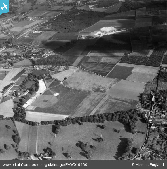
EAW019460 ENGLAND (1948). The East Malling Research Station (Horticultural) site and environs, East Malling, 1948. This image has been produced from a print.
© Copyright OpenStreetMap contributors and licensed by the OpenStreetMap Foundation. 2026. Cartography is licensed as CC BY-SA.
Nearby Images (3)
EAW019460
 site and environs, East Malling, 1948. This image has been produced from a print.")
EAW019461
 site and environs, East Malling, 1948. This image has been produced from a print.")
EAW018270
 site and Sports Ground, East Malling, 1948")
Details
| Title | [EAW019460] The East Malling Research Station (Horticultural) site and environs, East Malling, 1948. This image has been produced from a print. |
| Reference | EAW019460 |
| Date | 30-September-1948 |
| Link | |
| Place name | EAST MALLING |
| Parish | EAST MALLING AND LARKFIELD |
| District | |
| Country | ENGLAND |
| Easting / Northing | 570558, 157550 |
| Longitude / Latitude | 0.4463816319858, 51.290995788838 |
| National Grid Reference | TQ706576 |
Pins
Be the first to add a comment to this image!