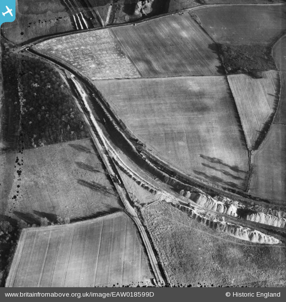
EAW018599D ENGLAND (1948). Opencast ironstone workings, Flixborough, 1948
© Copyright OpenStreetMap contributors and licensed by the OpenStreetMap Foundation. 2025. Cartography is licensed as CC BY-SA.
Details
| Title | [EAW018599D] Opencast ironstone workings, Flixborough, 1948 |
| Reference | EAW018599D |
| Date | 10-September-1948 |
| Link | |
| Place name | FLIXBOROUGH |
| Parish | FLIXBOROUGH |
| District | |
| Country | ENGLAND |
| Easting / Northing | 488364, 415022 |
| Longitude / Latitude | -0.66379573659587, 53.624032148167 |
| National Grid Reference | SE884150 |
Pins
User Comment Contributions
Thanks for the pins, the detail really helps. We'll update the catalogue and post the new data here in due course. Yours, Katy Britain from Above Cataloguing Team Leader |
Katy Whitaker |
Tuesday 7th of January 2014 03:53:15 PM |
View is looking east |

Class31 |
Thursday 19th of December 2013 06:30:12 AM |
Same fields as EAW018599G which has been located. |

Tony D |
Wednesday 18th of December 2013 01:28:03 PM |


![[EAW018599D] Opencast ironstone workings, Flixborough, 1948](http://britainfromabove.org.uk/sites/all/libraries/aerofilms-images/public/100x100/EAW/018/EAW018599D.jpg)
![[EAW018599E] Opencast ironstone workings, Flixborough, 1948. This image has been produced from a damaged negative.](http://britainfromabove.org.uk/sites/all/libraries/aerofilms-images/public/100x100/EAW/018/EAW018599E.jpg)