
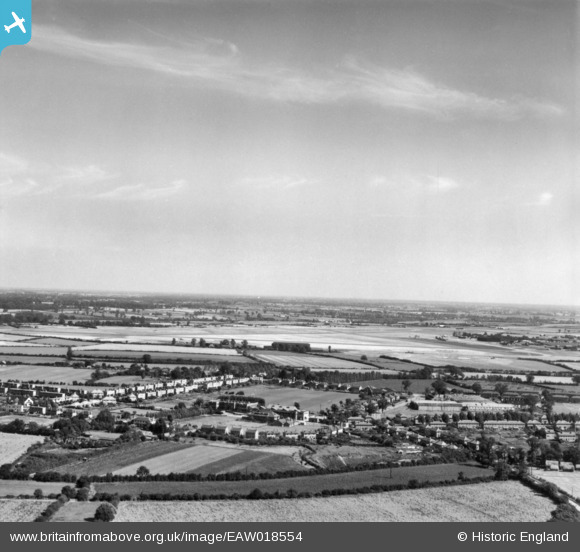
EAW018554 ENGLAND (1948). The village and environs, Silver End, from the south-west, 1948. This image has been produced from a print.
© Copyright OpenStreetMap contributors and licensed by the OpenStreetMap Foundation. 2026. Cartography is licensed as CC BY-SA.
Nearby Images (7)
EAW018554

EAW018557

EAW018561

EAW018559

EAW018555

EAW018552

EAW018551

Details
| Title | [EAW018554] The village and environs, Silver End, from the south-west, 1948. This image has been produced from a print. |
| Reference | EAW018554 |
| Date | 9-September-1948 |
| Link | |
| Place name | SILVER END |
| Parish | SILVER END |
| District | |
| Country | ENGLAND |
| Easting / Northing | 580935, 219868 |
| Longitude / Latitude | 0.62715384560673, 51.84759941413 |
| National Grid Reference | TL809199 |
Pins

Graham Yaxley |
Monday 26th of January 2015 06:15:06 PM |