
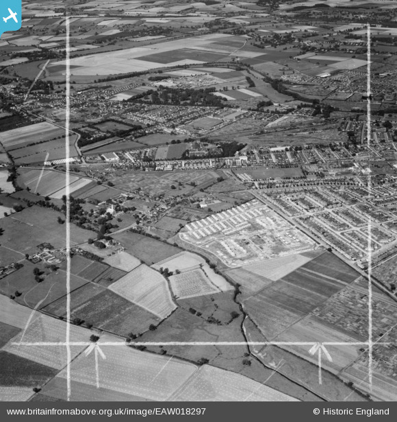
EAW018297 ENGLAND (1948). Construction of the prefabricated housing estate around Pilgrims Way and environs, Elstow, 1948. This image was marked by Aerofilms Ltd for photo editing.
© Copyright OpenStreetMap contributors and licensed by the OpenStreetMap Foundation. 2026. Cartography is licensed as CC BY-SA.
Nearby Images (3)
EAW018297

EAW018296

EAW018299

Details
| Title | [EAW018297] Construction of the prefabricated housing estate around Pilgrims Way and environs, Elstow, 1948. This image was marked by Aerofilms Ltd for photo editing. |
| Reference | EAW018297 |
| Date | 24-August-1948 |
| Link | |
| Place name | ELSTOW |
| Parish | ELSTOW |
| District | |
| Country | ENGLAND |
| Easting / Northing | 504972, 247700 |
| Longitude / Latitude | -0.46672247198678, 52.117229307824 |
| National Grid Reference | TL050477 |
Pins

BallisticBerry |
Saturday 4th of April 2020 09:54:00 PM | |
|
K9-Q |
Tuesday 3rd of November 2015 03:18:12 AM | |

Jet |
Tuesday 3rd of March 2015 03:51:20 PM | |
|
Jet |
Tuesday 3rd of March 2015 03:34:12 PM | |

melgibbs |
Thursday 6th of February 2014 06:37:06 PM | |
 |
melgibbs |
Thursday 6th of February 2014 06:35:35 PM |
User Comment Contributions
See also image EAW018296. |
melgibbs |
Thursday 6th of February 2014 06:37:59 PM |