
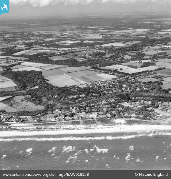
EAW018158 ENGLAND (1948). The village and the seafront, Milford on Sea, from the south-west, 1948. This image has been produced from a print.
© Copyright OpenStreetMap contributors and licensed by the OpenStreetMap Foundation. 2026. Cartography is licensed as CC BY-SA.
Nearby Images (2)
EAW018158

EAW050049

Details
| Title | [EAW018158] The village and the seafront, Milford on Sea, from the south-west, 1948. This image has been produced from a print. |
| Reference | EAW018158 |
| Date | 16-August-1948 |
| Link | |
| Place name | MILFORD ON SEA |
| Parish | MILFORD-ON-SEA |
| District | |
| Country | ENGLAND |
| Easting / Northing | 428032, 91875 |
| Longitude / Latitude | -1.6028130035778, 50.725246582974 |
| National Grid Reference | SZ280919 |
Pins
Be the first to add a comment to this image!