
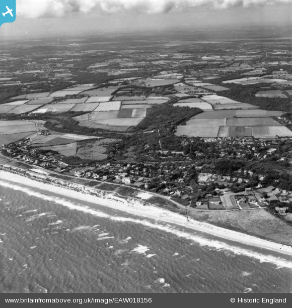
EAW018156 ENGLAND (1948). The village and the seafront, Milford on Sea, from the south-east, 1948. This image has been produced from a print.
© Copyright OpenStreetMap contributors and licensed by the OpenStreetMap Foundation. 2026. Cartography is licensed as CC BY-SA.
Nearby Images (3)
EAW018156

EAW050051

EAW050049

Details
| Title | [EAW018156] The village and the seafront, Milford on Sea, from the south-east, 1948. This image has been produced from a print. |
| Reference | EAW018156 |
| Date | 16-August-1948 |
| Link | |
| Place name | MILFORD ON SEA |
| Parish | MILFORD-ON-SEA |
| District | |
| Country | ENGLAND |
| Easting / Northing | 428193, 91608 |
| Longitude / Latitude | -1.6005522611427, 50.722837530055 |
| National Grid Reference | SZ282916 |
