
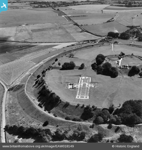
EAW018149 ENGLAND (1948). The hillfort and remains of the cathedral and castle, Old Sarum, 1948. This image has been produced from a print.
© Copyright OpenStreetMap contributors and licensed by the OpenStreetMap Foundation. 2026. Cartography is licensed as CC BY-SA.
Nearby Images (10)
EAW018149

EAW018147

EAW018151

EAW018148

EAW018150

EAW005103

EAW005101

EAW005100

EPW016856

EAW005099

Details
| Title | [EAW018149] The hillfort and remains of the cathedral and castle, Old Sarum, 1948. This image has been produced from a print. |
| Reference | EAW018149 |
| Date | 16-August-1948 |
| Link | |
| Place name | OLD SARUM |
| Parish | SALISBURY |
| District | |
| Country | ENGLAND |
| Easting / Northing | 413754, 132813 |
| Longitude / Latitude | -1.8035734360088, 51.093930507791 |
| National Grid Reference | SU138328 |
Pins

redmist |
Monday 24th of August 2020 09:25:42 PM | |
|
redmist |
Monday 24th of August 2020 09:02:12 PM | |
|
redmist |
Monday 24th of August 2020 09:00:05 PM | |
|
redmist |
Monday 24th of August 2020 08:59:54 PM | |
|
redmist |
Monday 24th of August 2020 08:58:52 PM | |
|
redmist |
Monday 24th of August 2020 08:58:32 PM |