
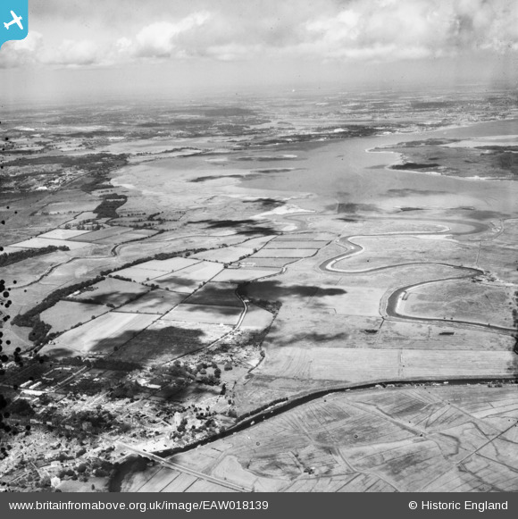
EAW018139 ENGLAND (1948). St Mary's Church, the Wareham Channel and the surrounding countryside, Wareham, from the south-west, 1948
© Copyright OpenStreetMap contributors and licensed by the OpenStreetMap Foundation. 2026. Cartography is licensed as CC BY-SA.
Nearby Images (2)
EAW018139

EAW018140

Details
| Title | [EAW018139] St Mary's Church, the Wareham Channel and the surrounding countryside, Wareham, from the south-west, 1948 |
| Reference | EAW018139 |
| Date | 16-August-1948 |
| Link | |
| Place name | WAREHAM |
| Parish | WAREHAM TOWN |
| District | |
| Country | ENGLAND |
| Easting / Northing | 392730, 87234 |
| Longitude / Latitude | -2.1029188596243, 50.684137704603 |
| National Grid Reference | SY927872 |
Pins


User Comment Contributions

South Street, Wareham, 06/07/2013 |

Class31 |
Sunday 21st of December 2014 05:42:03 PM |