
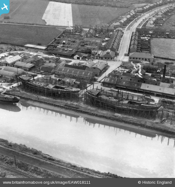
EAW018111 ENGLAND (1948). The Cochrane and Sons Ltd Ouse Shipbuilding Yard and Carr Street, Selby, 1948. This image has been produced from a print.
© Copyright OpenStreetMap contributors and licensed by the OpenStreetMap Foundation. 2026. Cartography is licensed as CC BY-SA.
Nearby Images (18)
EAW018111

EAW018105

EAW018107

EAW018108

EAW018114

EAW018104

EAW018106

EAW018115

EAW018109

EAW018113

EAW018110

EPW031647

EPW031651

EPW031648

EPW031650

EPW031649

EPW031645

EAW018112

Details
| Title | [EAW018111] The Cochrane and Sons Ltd Ouse Shipbuilding Yard and Carr Street, Selby, 1948. This image has been produced from a print. |
| Reference | EAW018111 |
| Date | 11-August-1948 |
| Link | |
| Place name | SELBY |
| Parish | SELBY |
| District | |
| Country | ENGLAND |
| Easting / Northing | 462594, 432037 |
| Longitude / Latitude | -1.0499701249131, 53.780677074638 |
| National Grid Reference | SE626320 |
Pins
Be the first to add a comment to this image!