
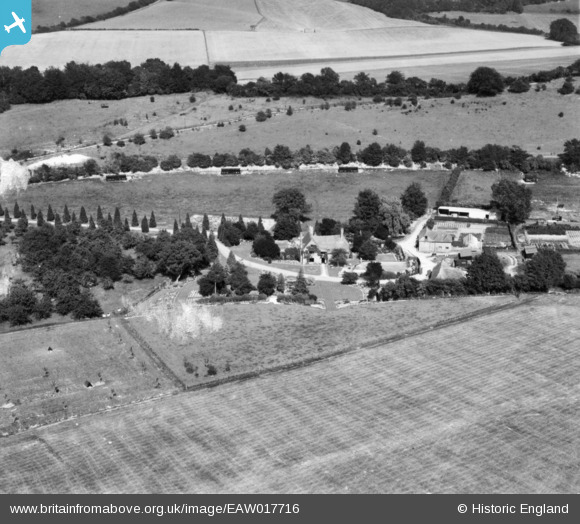
EAW017716 ENGLAND (1948). Crundale House, Crundale, 1948. This image has been produced from a damaged print.
© Copyright OpenStreetMap contributors and licensed by the OpenStreetMap Foundation. 2026. Cartography is licensed as CC BY-SA.
Nearby Images (4)
EAW017716

EAW017715

EAW017714

EAW017717

Details
| Title | [EAW017716] Crundale House, Crundale, 1948. This image has been produced from a damaged print. |
| Reference | EAW017716 |
| Date | 29-July-1948 |
| Link | |
| Place name | CRUNDALE |
| Parish | CRUNDALE |
| District | |
| Country | ENGLAND |
| Easting / Northing | 608253, 148750 |
| Longitude / Latitude | 0.9812221186185, 51.19943048188 |
| National Grid Reference | TR083488 |
Pins
Be the first to add a comment to this image!