
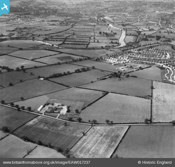
EAW017237 ENGLAND (1948). Fields around Harlescott County Junior School and Oldheath, Shrewsbury, 1948. This image has been produced from a print.
© Copyright OpenStreetMap contributors and licensed by the OpenStreetMap Foundation. 2026. Cartography is licensed as CC BY-SA.
Nearby Images (2)
EAW017237

EAW017236

Details
| Title | [EAW017237] Fields around Harlescott County Junior School and Oldheath, Shrewsbury, 1948. This image has been produced from a print. |
| Reference | EAW017237 |
| Date | 19-July-1948 |
| Link | |
| Place name | SHREWSBURY |
| Parish | SHREWSBURY |
| District | |
| Country | ENGLAND |
| Easting / Northing | 351521, 315054 |
| Longitude / Latitude | -2.717990818611, 52.730610363563 |
| National Grid Reference | SJ515151 |
Pins

Matt Aldred edob.mattaldred.com |
Wednesday 6th of March 2024 07:43:47 PM | |
|
Matt Aldred edob.mattaldred.com |
Wednesday 6th of March 2024 07:43:34 PM |