
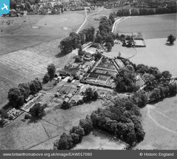
EAW017080 ENGLAND (1948). Dunsborough House and Farm, Ripley Green, 1948
© Copyright OpenStreetMap contributors and licensed by the OpenStreetMap Foundation. 2025. Cartography is licensed as CC BY-SA.
Nearby Images (6)
EAW017080

EAW017081

EAW017085

EAW017082

EAW017084

EAW017083

Details
| Title | [EAW017080] Dunsborough House and Farm, Ripley Green, 1948 |
| Reference | EAW017080 |
| Date | 6-July-1948 |
| Link | |
| Place name | RIPLEY GREEN |
| Parish | RIPLEY |
| District | |
| Country | ENGLAND |
| Easting / Northing | 505250, 157316 |
| Longitude / Latitude | -0.48996871853147, 51.304714551727 |
| National Grid Reference | TQ053573 |
Pins
Be the first to add a comment to this image!