
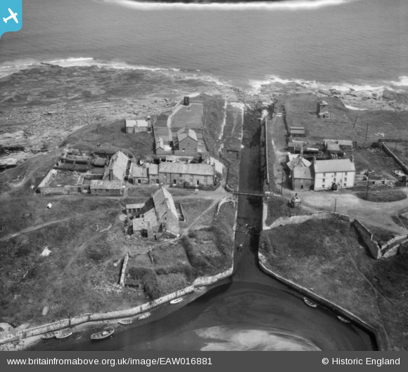
EAW016881 ENGLAND (1948). Seaton Sluice Harbour, Seaton Sluice, 1948
© Copyright OpenStreetMap contributors and licensed by the OpenStreetMap Foundation. 2026. Cartography is licensed as CC BY-SA.
Nearby Images (7)
EAW016881

EAW016882

EAW016879

EAW016880

EAW016878

EAW016877

EAW016855

Details
| Title | [EAW016881] Seaton Sluice Harbour, Seaton Sluice, 1948 |
| Reference | EAW016881 |
| Date | 24-June-1948 |
| Link | |
| Place name | SEATON SLUICE |
| Parish | SEATON VALLEY |
| District | |
| Country | ENGLAND |
| Easting / Northing | 433794, 576822 |
| Longitude / Latitude | -1.4705403632019, 55.08462619424 |
| National Grid Reference | NZ338768 |
Pins
Be the first to add a comment to this image!