
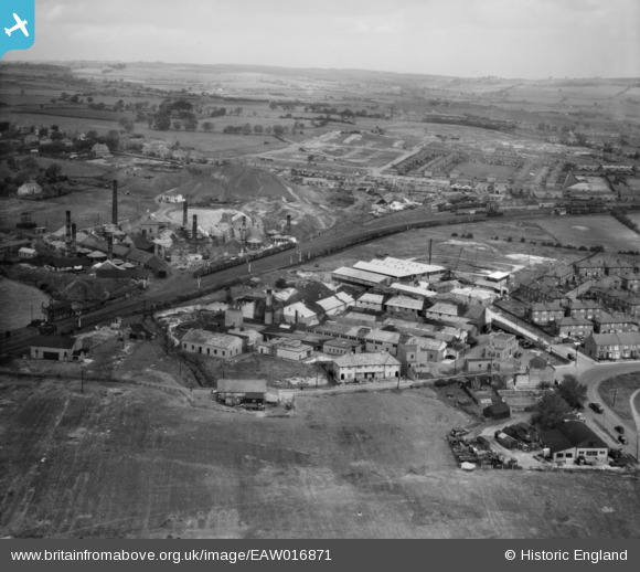
EAW016871 ENGLAND (1948). Marshall Richards Machine Company Works and environs, Crook, from the south-east, 1948
© Copyright OpenStreetMap contributors and licensed by the OpenStreetMap Foundation. 2026. Cartography is licensed as CC BY-SA.
Nearby Images (27)
EAW016871

EAW016864

EPW060891

EPW060890

EAW016867

EAW016866

EPW060897

EPW060896

EPW060888

EPW060889

EPW060892

EPW060894

EAW000855

EAW016873

EPW060887

EPW060893

EAW016875

EAW016876

EAW016865

EAW000856

EPW060895

EAW000857

EAW000858

EAW016869

EAW000858A

EAW016870

EAW016872

Details
| Title | [EAW016871] Marshall Richards Machine Company Works and environs, Crook, from the south-east, 1948 |
| Reference | EAW016871 |
| Date | 24-June-1948 |
| Link | |
| Place name | CROOK |
| Parish | |
| District | |
| Country | ENGLAND |
| Easting / Northing | 416205, 534829 |
| Longitude / Latitude | -1.7484702439764, 54.708109233958 |
| National Grid Reference | NZ162348 |
Pins
Be the first to add a comment to this image!