
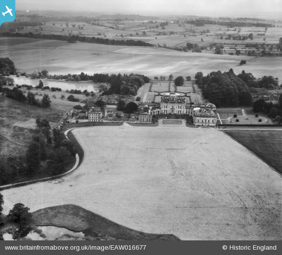
EAW016677 ENGLAND (1948). Castle Howard House and Grounds, Castle Howard, from the north, 1948
© Copyright OpenStreetMap contributors and licensed by the OpenStreetMap Foundation. 2026. Cartography is licensed as CC BY-SA.
Nearby Images (2)
EAW016677

EAW016679

Details
| Title | [EAW016677] Castle Howard House and Grounds, Castle Howard, from the north, 1948 |
| Reference | EAW016677 |
| Date | 23-June-1948 |
| Link | |
| Place name | CASTLE HOWARD |
| Parish | HENDERSKELFE |
| District | |
| Country | ENGLAND |
| Easting / Northing | 471601, 470252 |
| Longitude / Latitude | -0.90432350294857, 54.122960172745 |
| National Grid Reference | SE716703 |
