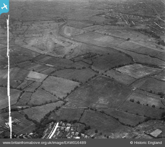
EAW016489 ENGLAND (1948). Sale Golf Course and the site for the University of Manchester Sports Ground, Northenden, 1948. This image has been produced from a print marked by Aerofilms Ltd for photo editing.
    © Copyright OpenStreetMap contributors and licensed by the OpenStreetMap Foundation. 2025. Cartography is licensed as CC BY-SA.
  
Nearby Images (10)
Details
| Title | [EAW016489] Sale Golf Course and the site for the University of Manchester Sports Ground, Northenden, 1948. This image has been produced from a print marked by Aerofilms Ltd for photo editing. | 
| Reference | EAW016489 | 
| Date | 11-July-1948 | 
| Link | |
| Place name | NORTHENDEN | 
| Parish | |
| District | |
| Country | ENGLAND | 
| Easting / Northing | 381725, 391378 | 
| Longitude / Latitude | -2.2750065062325, 53.41862768577 | 
| National Grid Reference | SJ817914 | 
Pins
|  Raymond Road, Northe(r)n Moor, Northenden |   John Ellis | Thursday 27th of November 2014 08:04:47 PM | 
|  Sale Lodge (I think!) |   John Ellis | Thursday 27th of November 2014 07:08:01 PM | 
|  Sale Golf Course |   John Ellis | Thursday 27th of November 2014 07:05:03 PM | 
|  Rifle Road |   John Ellis | Thursday 27th of November 2014 07:03:59 PM | 
|  The Bridge Inn, and Jackson's Bridge - footbridge over the Mersey. |   John Ellis | Thursday 27th of November 2014 07:03:17 PM | 
|  Grounds of Cleveland Lodge, Sale Road, Northe(r)n Moor |   John Ellis | Thursday 27th of November 2014 06:58:31 PM | 
|  Waterside Farm, Sale Moor |   John Ellis | Thursday 27th of November 2014 06:55:14 PM | 
|  Carloon House |   John Ellis | Thursday 27th of November 2014 06:52:46 PM | 
|  Fairy Lane, towards Sale Moor |   John Ellis | Thursday 27th of November 2014 06:51:43 PM | 
|  Oak Farm, Sale Moor |   John Ellis | Thursday 27th of November 2014 06:50:00 PM | 
|  River Mersey - historic boundary between Cheshire and Lancashire |   John Ellis | Thursday 27th of November 2014 05:01:00 PM | 
|  Chorlton Green |   John Ellis | Thursday 27th of November 2014 04:55:11 PM | 
|  CHORLTON shopping centre and bus station. |   John Ellis | Thursday 27th of November 2014 04:53:31 PM | 
|  Barlow Moor Road (now A5145), Chorlton-cum-Hardy |   John Ellis | Thursday 27th of November 2014 04:52:26 PM | 
|  The line of trees marks the course of the Chorlton Brook |   John Ellis | Thursday 27th of November 2014 04:51:18 PM | 
|  Dagnall Avenue, Chollton-cum-Hardy |   John Ellis | Thursday 27th of November 2014 04:50:10 PM | 
|  Darley Avenue, Chorlton-cum-Hardy |   John Ellis | Thursday 27th of November 2014 04:48:56 PM | 
|  Chorltonville garden suburb |   John Ellis | Thursday 27th of November 2014 04:47:40 PM | 
|  Hardy Lane, Chorlton-cum-Hardy |   John Ellis | Thursday 27th of November 2014 04:46:28 PM | 
|  Cundiff Road, Chorlton-cum-Hardy |   John Ellis | Thursday 27th of November 2014 04:45:37 PM | 
|  Hurstville Road, Chorlton-cum-Hardy |   John Ellis | Thursday 27th of November 2014 04:38:02 PM | 
User Comment Contributions
| Looking roughly north-west. |   John Ellis | Friday 28th of November 2014 09:01:44 AM | 
 
             
  ![[EAW016489] Sale Golf Course and the site for the University of Manchester Sports Ground, Northenden, 1948. This image has been produced from a print marked by Aerofilms Ltd for photo editing.](http://britainfromabove.org.uk/sites/all/libraries/aerofilms-images/public/100x100/EAW/016/EAW016489.jpg) 
  
                                          ![[EAW016490] The site for the University of Manchester Sports Ground, Northenden, 1948. This image has been produced from a print marked by Aerofilms Ltd for photo editing.](http://britainfromabove.org.uk/sites/all/libraries/aerofilms-images/public/100x100/EAW/016/EAW016490.jpg) 
 ![[EPW017443] Fields around Waterside Farm and the Sale and Chorlton-cum-Hardy Golf Courses, Northenden, 1927](http://britainfromabove.org.uk/sites/all/libraries/aerofilms-images/public/100x100/EPW/017/EPW017443.jpg) 
 ![[EAW016770] Fields between Northern Moor and the River Mersey, Northenden, 1948](http://britainfromabove.org.uk/sites/all/libraries/aerofilms-images/public/100x100/EAW/016/EAW016770.jpg) 
 ![[EAW016767] Fields between Northern Moor and the River Mersey, Northenden, 1948](http://britainfromabove.org.uk/sites/all/libraries/aerofilms-images/public/100x100/EAW/016/EAW016767.jpg) 
 ![[EAW016491] The site for the University of Manchester Sports Ground and Barlow Moor, Northenden, 1948. This image has been produced from a print marked by Aerofilms Ltd for photo editing.](http://britainfromabove.org.uk/sites/all/libraries/aerofilms-images/public/100x100/EAW/016/EAW016491.jpg) 
 ![[EAW016771] Fields between Northern Moor and the River Mersey, Northenden, 1948](http://britainfromabove.org.uk/sites/all/libraries/aerofilms-images/public/100x100/EAW/016/EAW016771.jpg) 
 ![[EAW016766] Fields between Northern Moor and the River Mersey, Northenden, 1948](http://britainfromabove.org.uk/sites/all/libraries/aerofilms-images/public/100x100/EAW/016/EAW016766.jpg) 
 ![[EAW016493] The site for the University of Manchester Sports Ground, Northenden, 1948. This image has been produced from a print marked by Aerofilms Ltd for photo editing.](http://britainfromabove.org.uk/sites/all/libraries/aerofilms-images/public/100x100/EAW/016/EAW016493.jpg) 
 ![[EAW016492] The site for the University of Manchester Sports Ground, Northenden, 1948. This image has been produced from a print marked by Aerofilms Ltd for photo editing.](http://britainfromabove.org.uk/sites/all/libraries/aerofilms-images/public/100x100/EAW/016/EAW016492.jpg)