
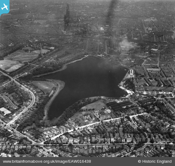
EAW016438 ENGLAND (1948). Edgbaston Reservoir, Rotton Park, 1948. This image has been produced from a print.
© Copyright OpenStreetMap contributors and licensed by the OpenStreetMap Foundation. 2026. Cartography is licensed as CC BY-SA.
Nearby Images (4)
EAW016438

EAW016436

EAW016435

EPW054236

Details
| Title | [EAW016438] Edgbaston Reservoir, Rotton Park, 1948. This image has been produced from a print. |
| Reference | EAW016438 |
| Date | 9-June-1948 |
| Link | |
| Place name | ROTTON PARK |
| Parish | |
| District | |
| Country | ENGLAND |
| Easting / Northing | 404330, 286819 |
| Longitude / Latitude | -1.9362382102364, 52.478910802388 |
| National Grid Reference | SP043868 |
Pins

redmist |
Monday 1st of November 2021 06:47:11 PM |