
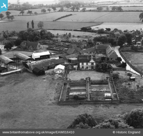
EAW016410 ENGLAND (1948). Sambrook Hall, Sambrook, 1948. This image has been produced from a print.
© Copyright OpenStreetMap contributors and licensed by the OpenStreetMap Foundation. 2024. Cartography is licensed as CC BY-SA.
Nearby Images (3)
EAW016410

EAW016409

EAW016408

Details
| Title | [EAW016410] Sambrook Hall, Sambrook, 1948. This image has been produced from a print. |
| Reference | EAW016410 |
| Date | 9-June-1948 |
| Link | |
| Place name | SAMBROOK |
| Parish | CHETWYND |
| District | |
| Country | ENGLAND |
| Easting / Northing | 371445, 324612 |
| Longitude / Latitude | -2.4237549367489, 52.817959052348 |
| National Grid Reference | SJ714246 |
Pins
Be the first to add a comment to this image!