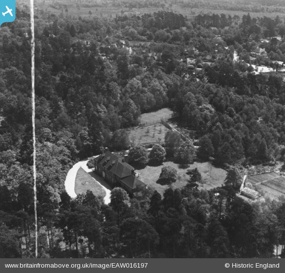
EAW016197 ENGLAND (1948). Danewell House off Woodham Lane, Woking, 1948. This image has been produced from a print marked by Aerofilms Ltd for photo editing.
© Copyright OpenStreetMap contributors and licensed by the OpenStreetMap Foundation. 2025. Cartography is licensed as CC BY-SA.
Nearby Images (6)
Details
| Title | [EAW016197] Danewell House off Woodham Lane, Woking, 1948. This image has been produced from a print marked by Aerofilms Ltd for photo editing. |
| Reference | EAW016197 |
| Date | 8-June-1948 |
| Link | |
| Place name | WOKING |
| Parish | |
| District | |
| Country | ENGLAND |
| Easting / Northing | 501714, 160652 |
| Longitude / Latitude | -0.539729908429, 51.335347762125 |
| National Grid Reference | TQ017607 |
Pins
Be the first to add a comment to this image!


![[EAW016197] Danewell House off Woodham Lane, Woking, 1948. This image has been produced from a print marked by Aerofilms Ltd for photo editing.](http://britainfromabove.org.uk/sites/all/libraries/aerofilms-images/public/100x100/EAW/016/EAW016197.jpg)
![[EAW016196] Danewell House off Woodham Lane, Woking, 1948. This image has been produced from a print marked by Aerofilms Ltd for photo editing.](http://britainfromabove.org.uk/sites/all/libraries/aerofilms-images/public/100x100/EAW/016/EAW016196.jpg)
![[EAW016199] Danewell House off Woodham Lane, Woking, 1948. This image has been produced from a print marked by Aerofilms Ltd for photo editing.](http://britainfromabove.org.uk/sites/all/libraries/aerofilms-images/public/100x100/EAW/016/EAW016199.jpg)
![[EAW016198] Danewell House off Woodham Lane, Woking, 1948. This image has been produced from a print marked by Aerofilms Ltd for photo editing.](http://britainfromabove.org.uk/sites/all/libraries/aerofilms-images/public/100x100/EAW/016/EAW016198.jpg)
![[EAW016201] Danewell House off Woodham Lane, Woking, 1948. This image has been produced from a print marked by Aerofilms Ltd for photo editing.](http://britainfromabove.org.uk/sites/all/libraries/aerofilms-images/public/100x100/EAW/016/EAW016201.jpg)
![[EAW016200] Danewell House off Woodham Lane, Woking, 1948. This image has been produced from a print.](http://britainfromabove.org.uk/sites/all/libraries/aerofilms-images/public/100x100/EAW/016/EAW016200.jpg)