
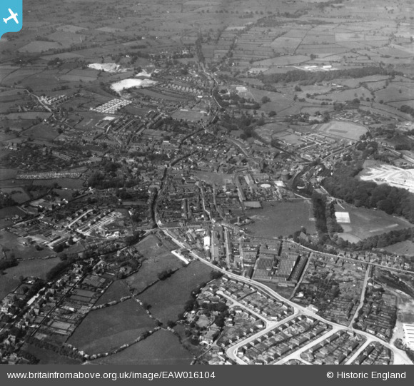
EAW016104 ENGLAND (1948). The town, Congleton, from the east, 1948. This image has been produced from a print.
© Copyright OpenStreetMap contributors and licensed by the OpenStreetMap Foundation. 2026. Cartography is licensed as CC BY-SA.
Nearby Images (14)
EAW016104

EAW035040

EAW035037

EPW028123

EAW035031

EAW035036

EAW035032

EAW035033

EAW035038

EAW035035

EAW035034

EAW016105

EAW035039

EAW016103

Details
| Title | [EAW016104] The town, Congleton, from the east, 1948. This image has been produced from a print. |
| Reference | EAW016104 |
| Date | 21-May-1948 |
| Link | |
| Place name | CONGLETON |
| Parish | CONGLETON |
| District | |
| Country | ENGLAND |
| Easting / Northing | 386531, 362975 |
| Longitude / Latitude | -2.2014803398088, 53.163437263219 |
| National Grid Reference | SJ865630 |
Pins

John |
Friday 1st of May 2020 08:16:52 AM |