
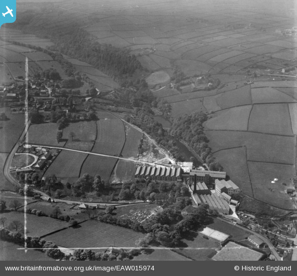
EAW015974 ENGLAND (1948). The Dobroyd Ltd Woollen Mill and environs, Hepworth, 1948. This image has been produced from a print marked by Aerofilms Ltd for photo editing.
© Copyright OpenStreetMap contributors and licensed by the OpenStreetMap Foundation. 2025. Cartography is licensed as CC BY-SA.
Nearby Images (38)
EAW015974

EAW015976

EAW013713

EAW015977

EAW051506

EAW013714

EAW015975

EAW013711

EAW013712

EAW013715

EAW051505

EAW051508

EAW015980

EAW013718

EAW015979

EAW009144

EPW062841

EAW015978

EAW009145

EAW051504

EAW009146

EAW004578

EAW009143A

EAW004576

EAW009147

EAW051511

EAW051507

EAW051509

EAW004574

EAW013717

EPW062839

EAW004579

EPW062840

EPW062837

EAW051510

EAW004575

EAW013716

EAW004577

Details
| Title | [EAW015974] The Dobroyd Ltd Woollen Mill and environs, Hepworth, 1948. This image has been produced from a print marked by Aerofilms Ltd for photo editing. |
| Reference | EAW015974 |
| Date | 19-May-1948 |
| Link | |
| Place name | HEPWORTH |
| Parish | HOLME VALLEY |
| District | |
| Country | ENGLAND |
| Easting / Northing | 416216, 407079 |
| Longitude / Latitude | -1.7551660003429, 53.559837513411 |
| National Grid Reference | SE162071 |
Pins
Be the first to add a comment to this image!