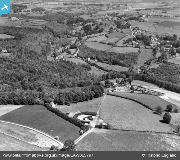
EAW015797 ENGLAND (1948). Toadsmoor Valley, Quarhouse, 1948. This image has been produced from a print.
© Copyright OpenStreetMap contributors and licensed by the OpenStreetMap Foundation. 2024. Cartography is licensed as CC BY-SA.
Details
| Title | [EAW015797] Toadsmoor Valley, Quarhouse, 1948. This image has been produced from a print. |
| Reference | EAW015797 |
| Date | 18-May-1948 |
| Link | |
| Place name | QUARHOUSE |
| Parish | BRIMSCOMBE AND THRUPP |
| District | |
| Country | ENGLAND |
| Easting / Northing | 387931, 203614 |
| Longitude / Latitude | -2.1747733856018, 51.730653582752 |
| National Grid Reference | SO879036 |
Pins
Be the first to add a comment to this image!


![[EAW015797] Toadsmoor Valley, Quarhouse, 1948. This image has been produced from a print.](http://britainfromabove.org.uk/sites/all/libraries/aerofilms-images/public/100x100/EAW/015/EAW015797.jpg)
![[EPW058874] Steepways, Quarhouse, 1938](http://britainfromabove.org.uk/sites/all/libraries/aerofilms-images/public/100x100/EPW/058/EPW058874.jpg)
![[EPW058872] Steepways, Quarhouse, 1938](http://britainfromabove.org.uk/sites/all/libraries/aerofilms-images/public/100x100/EPW/058/EPW058872.jpg)
![[EPW058876] Steepways, Quarhouse, 1938](http://britainfromabove.org.uk/sites/all/libraries/aerofilms-images/public/100x100/EPW/058/EPW058876.jpg)