
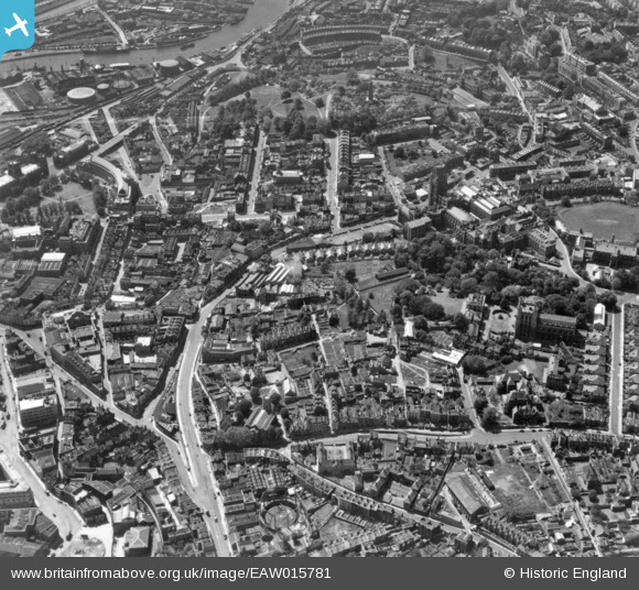
EAW015781 ENGLAND (1948). Tyndall's Park, Bristol, 1948. This image has been produced from a print.
© Copyright OpenStreetMap contributors and licensed by the OpenStreetMap Foundation. 2026. Cartography is licensed as CC BY-SA.
Nearby Images (19)
EAW015781

EAW015782

EPW041484

EPW022270

EPW011998

EPW047091

EPW033150

EPW033151

EPW033148

EAW015779

EAW000735

EAW000736

EAW015784

EPW047092

EAW002259

EAW015783

EPW022271

EAW050557

EPW022275

Details
| Title | [EAW015781] Tyndall's Park, Bristol, 1948. This image has been produced from a print. |
| Reference | EAW015781 |
| Date | 18-May-1948 |
| Link | |
| Place name | BRISTOL |
| Parish | |
| District | |
| Country | ENGLAND |
| Easting / Northing | 358315, 173192 |
| Longitude / Latitude | -2.6000165009583, 51.455682700211 |
| National Grid Reference | ST583732 |
Pins

Ian S |
Sunday 18th of August 2024 11:52:39 AM |
