
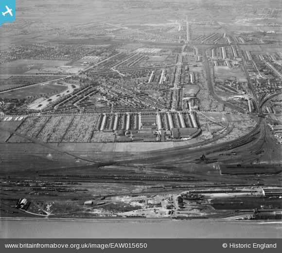
EAW015650 ENGLAND (1948). The Gipsyville Works and environs, Gipsyville, 1948
© Copyright OpenStreetMap contributors and licensed by the OpenStreetMap Foundation. 2025. Cartography is licensed as CC BY-SA.
Nearby Images (2)
EAW015650

EPW012822

Details
| Title | [EAW015650] The Gipsyville Works and environs, Gipsyville, 1948 |
| Reference | EAW015650 |
| Date | 18-May-1948 |
| Link | |
| Place name | GIPSYVILLE |
| Parish | |
| District | |
| Country | ENGLAND |
| Easting / Northing | 506380, 427272 |
| Longitude / Latitude | -0.38727337617941, 53.73075589858 |
| National Grid Reference | TA064273 |
Pins

redmist |
Monday 18th of October 2021 02:09:54 PM | |
|
redmist |
Monday 18th of October 2021 02:09:22 PM | |
|
redmist |
Monday 18th of October 2021 02:07:52 PM | |
|
redmist |
Monday 18th of October 2021 02:05:38 PM | |
|
redmist |
Monday 18th of October 2021 02:05:17 PM | |
|
redmist |
Monday 18th of October 2021 02:05:00 PM | |
|
redmist |
Friday 11th of January 2019 08:53:29 PM | |
|
redmist |
Friday 11th of January 2019 08:40:12 PM | |
|
John Wass |
Tuesday 19th of August 2014 08:22:41 PM |