
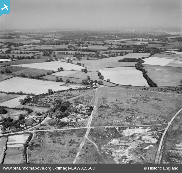
EAW015563 ENGLAND (1948). Nomansland Common and the surrounding countryside, Nomansland, from the west, 1948
© Copyright OpenStreetMap contributors and licensed by the OpenStreetMap Foundation. 2026. Cartography is licensed as CC BY-SA.
Nearby Images (3)
EAW015563

EAW015562

EAW003633

Details
| Title | [EAW015563] Nomansland Common and the surrounding countryside, Nomansland, from the west, 1948 |
| Reference | EAW015563 |
| Date | 13-May-1948 |
| Link | |
| Place name | NOMANSLAND |
| Parish | WHEATHAMPSTEAD |
| District | |
| Country | ENGLAND |
| Easting / Northing | 517151, 212589 |
| Longitude / Latitude | -0.30088562930007, 51.79921120136 |
| National Grid Reference | TL172126 |
