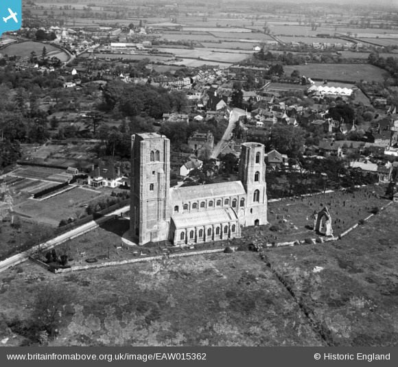
EAW015362 ENGLAND (1948). The Abbey Church of St Mary and St Thomas of Canterbury, Wymondham, 1948
© Copyright OpenStreetMap contributors and licensed by the OpenStreetMap Foundation. 2026. Cartography is licensed as CC BY-SA.
Details
| Title | [EAW015362] The Abbey Church of St Mary and St Thomas of Canterbury, Wymondham, 1948 |
| Reference | EAW015362 |
| Date | 7-May-1948 |
| Link | |
| Place name | WYMONDHAM |
| Parish | WYMONDHAM |
| District | |
| Country | ENGLAND |
| Easting / Northing | 610711, 301574 |
| Longitude / Latitude | 1.109718820569, 52.570745651212 |
| National Grid Reference | TG107016 |


![[EAW015362] The Abbey Church of St Mary and St Thomas of Canterbury, Wymondham, 1948](http://britainfromabove.org.uk/sites/all/libraries/aerofilms-images/public/100x100/EAW/015/EAW015362.jpg)
![[EAW015361] The Abbey Church of St Mary and St Thomas of Canterbury, Wymondham, 1948](http://britainfromabove.org.uk/sites/all/libraries/aerofilms-images/public/100x100/EAW/015/EAW015361.jpg)
![[EPW039242] The Abbey Church of St Mary and St Thomas of Canterbury, Wymondham, 1932. This image has been produced from a copy-negative.](http://britainfromabove.org.uk/sites/all/libraries/aerofilms-images/public/100x100/EPW/039/EPW039242.jpg)
