
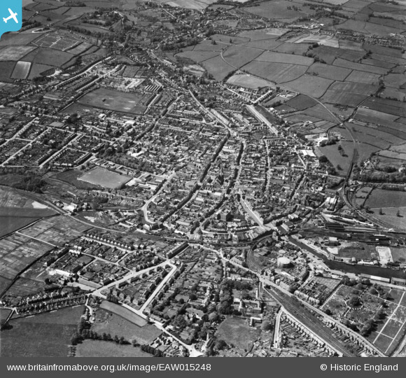
EAW015248 ENGLAND (1948). The town, Newport, from the north-east, 1948
© Copyright OpenStreetMap contributors and licensed by the OpenStreetMap Foundation. 2026. Cartography is licensed as CC BY-SA.
Nearby Images (4)
EAW015248

EPW023022

EAW015247

EAW022224

Details
| Title | [EAW015248] The town, Newport, from the north-east, 1948 |
| Reference | EAW015248 |
| Date | 6-May-1948 |
| Link | |
| Place name | NEWPORT |
| Parish | NEWPORT |
| District | |
| Country | ENGLAND |
| Easting / Northing | 450284, 89279 |
| Longitude / Latitude | -1.2878972132363, 50.700400533536 |
| National Grid Reference | SZ503893 |
Pins
Be the first to add a comment to this image!