
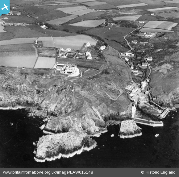
EAW015148 ENGLAND (1948). The harbour, Mullion Cove Hotel and environs, Mullion Cove, 1948. This image has been produced from a print.
© Copyright OpenStreetMap contributors and licensed by the OpenStreetMap Foundation. 2026. Cartography is licensed as CC BY-SA.
Nearby Images (2)
EAW015148

EAW015147

Details
| Title | [EAW015148] The harbour, Mullion Cove Hotel and environs, Mullion Cove, 1948. This image has been produced from a print. |
| Reference | EAW015148 |
| Date | 29-April-1948 |
| Link | |
| Place name | MULLION COVE |
| Parish | MULLION |
| District | |
| Country | ENGLAND |
| Easting / Northing | 166686, 17994 |
| Longitude / Latitude | -5.2572019000896, 50.015692585655 |
| National Grid Reference | SW667180 |
Pins

Matt Aldred edob.mattaldred.com |
Sunday 16th of May 2021 09:55:15 PM | |
|
Matt Aldred edob.mattaldred.com |
Sunday 29th of November 2020 08:53:48 PM | |

CornwallPhil |
Saturday 6th of September 2014 09:16:36 PM | |
Looks like a water tower to build up pressure for the Mullion Cove hotel and cottages. |
Rick |
Monday 29th of November 2021 09:43:01 PM |
|
CornwallPhil |
Saturday 6th of September 2014 09:14:11 PM |